HIKING TRAILS
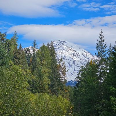
There are so many hikes to enjoy within the park, it is hard to find the right one! We have broken out some of them by category so you can find a good fit for your group, we've put together a list of good options nearby. These are also great options if you find yourself at Mt Rainier on a day that is very busy!
WATERFALL HIKES
Westside Road– This trail provides beautiful trees, a wonderful view of Mt. Wow, and has seasonal drainages that provide many chances to view the “Un-named Waterfalls” that fill this trail with its beauty. It is located just inside the Nisqually Entrance. Look for it on the left side of the road to Paradise 1 mile.
Carter Falls – This 80 foot drop is named after Harry Carter who built a large portion of the Paradise Trail. Just 8 miles inside the Nisqually Entrance on 706, you will travel eastward on the Wonderland Trail. The falls are clearly marked, but before reaching them you must first cross over the Nisqually River on one of two footbridges. Continue 1.3 miles up the trail to the falls.
Madcap Falls – This trail is a continuation of the Carter Falls trail, until you reach an unsigned spur trail. Enjoy this trail only 1.4 miles from the trailhead to view the Paradise River tumbling over 20 to 30 feet.
Narada Falls Viewpoint or Narada Falls – Hike along the Wonderland Trail past Carter Falls & Madcap Falls about 1.5 miles to witness this popular tourist attraction. Narada Falls runs 168 feet along a bedrock before plummeting another 73 feet to its base.
Comet Falls – In order to view this amazing waterfall, hike uphill 1.6 miles beyond the trailhead. Tree roots fill the soil underneath your feet but well worth the 320 foot drop that plunges from what seems like nowhere.
Upper Christine Falls – Park at Comet Falls trailhead, hike ¼ mile to the bridge.
Christine Falls – This waterfall is visable from the road, but getting out of the car is a must. Just .2 miles past Comet Falls trailhead pull over at the turnout on the east side of the bridge. Take the staircase down to view the hand placed stones that form the bridge giving Christine Falls the picture frame she deserves.
PARADISE WATERFALLS
Myrtle Falls – Take the Skyline Trail to the right (near the Paradise Inn). Walk this easy .3 miles to a stairway, follow them down to observe the breathtaking view.
Sluiskin Falls – This 300 foot run along the Paradise River is visible from the Jackson Visitor Center. Seeing it first hand is what you are looking for, then take the southern loop of the Skyline Trail 1.4 miles from the trailhead. At the junction, veer left .5 miles and here is where you will see the white water cascade of Sluiskin Falls. History of Sluiskin Falls – Defines the head waters of the Paradise River, cascading from the Paradise Glacier, 300 feet.
Fairy Falls – Is the longest cascading waterfall at Mt. Rainier National Park. Bring your binoculars – pull off at the Bench Lake Trailhead, and look across the highway.
Martha Falls – A series of falls best viewed from Stevens Canyon, accessed via the Wonderland Trail as well.
HIKES OUTSIDE PARK
Osborne Mountain Trail #250 5.5 Miles
This trail begins in Big Creek Campground (Road 5200.029) and climbs steeply through a moderately dense forest. The trail passes through a harvest area and climbs to the south side of Osborne Mountain. The trail is cut by a switchback from Road 8410 (at mile 4). Continuing southeast, the trail skirts a timber harvest area and ends on Teeley Creek Trail #251 near Pothole Lake (Lower Bertha May Lake). Features include Osborne Mountain, views of Mt. Rainier, the Nisqually River Valley, and Pothole Lake. Elevation ranges from 1800 to 4680 feet above sea level.
*A Northwest Forest Pass is required for this trail. This pass can be purchased from Ashford Valley Grocery, located on SR 706 in Ashford.
Teeley Creek Trail #251 4.3 Miles
The Teeley Creek Trail begins on Road 8410. It descends through a dense conifer forest to Pothole Lake (Lower Bertha May Lake). The trail skirts the lake, then meets with Osborne Mountain Trail #250, turns south and climbs steeply to Upper Bertha May Lake. Continuing east, it passes Granite Lake and follows the base of Sawtooth Ridge and High Rock, ending on Big Creek Trail #252 near Cora Lake. Elevation ranges from 3640 to 4500 feet above sea level.
Big Creek Trail #252 2.4 Miles
The Big Creek Trail begins on Road 8420 and climbs steeply to Big Creek and Cora Falls before reaching Cora Lake. Skirting the lake, it passes a junction with Teeley Creek Trail #251, enters a dense forest and climbs to its terminus on Road 8440. Features include Cora Falls, Cora Lake and High Rock. Elevation ranges from 3400 to 4640 feet above sea level.
Greenwood Lake Trail #253 3 Miles
The Greenwood Lake Trail is shown on maps, but is not currently being maintained. The trail is difficult to follow. Check with the Packwood District for current information. Elevation ranges from 4000 to 4750 feet above sea level.
*A Northwest Forest Pass is required for this trail. This pass can be purchased from Ashford Valley Grocery, located on SR 706 in Ashford.
Cave Creek Trail #255 .5 Miles
This is a short access trail from Road 8510 to Osborne Mountain Trail #250. Elevation ranges from 3680to 3840 feet.
Silver Creek Trail #258 4.5 Miles
Located near Bear Prairie, the Silver Creek Trail begins on Road 5240.015 and proceeds generally southwest on an easy grade through an old-growth forest until ending on Road 84. This trail is cut by road crossings with Road 5222.016, within the first section of the trail. Bear Prairie is a meadow at the headwaters of Skate Creek. Elevation ranges from 2880 to 4080 feet above sea level.
*A Northwest Forest Pass is required for this trail. This pass can be purchased from Ashford Valley Grocery, located on SR 706 in Ashford.
High Rock Trail #266 1.6 Miles
This trail takes hikers up to High Rock Lookout, one of three fire lookouts remaining on the Gifford Pinchot NF. The trail begins on Road 8440 and climbs steeply through increasingly sparse conifers to High Rock Lookout. High Rock is a prominent 5,685 feet high peak on Sawtooth Ridge with a sheer 600 foot drop on its north face. Please use caution when exploring this area. Stay behind the cables. The lookout offers incredible views of the Sawtooth Ridge, Mt. Rainier and much of the surrounding landscape. Trailhead: High Rock – Trailhead is at the intersection of FR 8440 and the southern end of High Rock Trail No. 266. Elevation ranges from 4320 to 5685 feet above sea level.
*A Northwest Forest Pass is required for this trail. This pass can be purchased from Ashford Valley Grocery, located on SR 706 in Ashford.
Allen Mountain Trail #269 4 Miles
Formerly Skate Mountain Trail, this lightly used trail begins on Road 8460 and climbs 2.5 miles to the top of Allen Mountain. Here it enters the open, subalpine landscape and follows the Ridge to its junction with Greenwood Lake Trail #253. Elevation ranges from 4240 to 4720 feet above sea level.
*A Northwest Forest Pass is required for this trail. This pass can be purchased from Ashford Valley Grocery, located on SR 706 in Ashford.
Tatoosh Trail #161 9 Miles
The Tatoosh Trail begins on Road 5270. It climbs through dense forest for approximately 2 miles before coming to the open subalpine terrain of Tatoosh Ridge. Following the ridge south, the trail passes many scenic openings then descends steeply to Road 5290. (Steep with exposures. Limited trailhead space at both ends. Camping opportunities along the trail are limited). The Tatoosh Trail was originally built to access a grazing allotment for cattle. There was also a Native American trail up Tatoosh Ridge, east of the existing trail. Parts of this trail can still be found today.
Elevation ranges from 2400 to 5800 feet above sea level.
Tatoosh Lookout Trail #161a 1 Mile
The Lookout Trail is a short access trail from the Tatoosh Trail #161. It takes you to the site where a fire lookout once stood. Features from the lookout site include outstanding views of Mt Rainier and the Tatoosh Ridge.
Elevation ranges from 5800 to 6310 feet above sea level.
Tatoosh Lake Trail #161b .5 Miles
Trail #161b leaves the Tatoosh Trail #161, climbing a fairly steep grade to the top of the ridge. The trail tread is badly eroded. The trail then descends steeply to Tatoosh Lake. (No camping, stock, or campfires are allowed at Tatoosh Lake).
Elevation ranges from 5000 to 5650 feet above sea level.
OUR PERSONAL FAVORITES
These are all easy to moderate hikes. Each provide a certain 'WOW' factor and a quintessential Rainier experience.
Near Nisqually Entrance/Longmire Visitor's Center:
- Comet Falls
- Skyline Trail
- Trail of the Shadows
- Reflection Lake to Paradise
- Tahoma Suspension Bridge
- Indian Henry's Hunting Ground (Best place to View Wildflowers)
Outside of Park:
- High Rocks Lookout Tower
- Mt Beljica/Christine Lake
- Bertha Lake/Granite Lake/Cora Lake hike
Hiker's Haven: Hiking Guide

Important information
- Year-Round Access: The Nisqually Entrance is open year-round, mkaing it the only entrance accessible during winter months when other areas may be closed due to snow.
- Time Entry: From Memorial Day to Labor Day, a timed entry ticket is required to visit the park between 7am and 3pm. If you don't have a ticket, plan to visit before 7am or after 3pm.
- Visitor Amenities: The area around the Nisqually Entrance has facilities such as restrooms, food and information at the Visit Center, which is a great starting point for your hiking adventure.
tips for hiking
- Check Conditions: Before heading out, check the Mount Rainier Webcam for real-time conditions and visibility.
- Prepare for Weather: Weather can change rapidly in the mountains, so dress in layers and be prepared for varying condintions.
- Stay Hydrated: Bring plenty of water and snacks, especially for longer hikes. These trails and tips will help you enjoy a memorable hiking experience at Mount Rainier from the Nisqually Entrance!